¶ Latest beta is JMT 4.5 beta 17

¶ Preamble
Google changed access rights for apps in Android 10.
This JMT built with different accesses to your data.
- Please backup all your JMT data from javad folder! *
¶ New Features
-
AR in stakeout
With Triumph-3 receiver, Augment Reality stakeout (aka Visual Stakeout) is available in JMT. The feature is available only on controllers with AR support, list such devices is by the. Special Android device is required with support of AR. Please see list of Google sertified devices for AR.

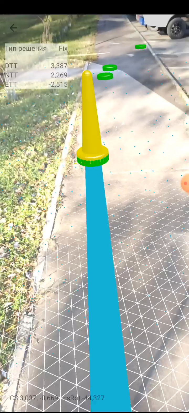
Video youtube -
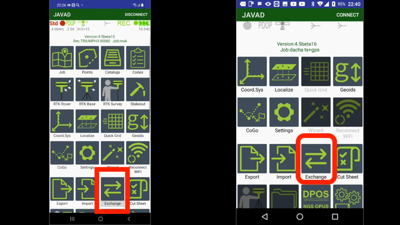
Data Exchange between controllers.
With Exchange feature user can share information from one controller to another one. Jobs, points, survey settings, catalogs, correction sources, coordinate systems or just files. Different methods to exchange exist – Bluetooth, WiFi Direct, Ethernet, Ext.Disk or SD Card, Camera with QRCode or Audio.
Then you need to send something to another controller woth JMT you need this feature. Five different variants are possible.
 .
. 
Video youtube -
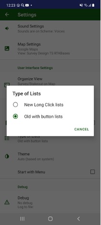
New design of lists
Previously list items were controlled with i-buttons on left, with new user interface you can click on an item and edit dialog will be opened and to select / handle several items can be activated with long click. Switch between the modes can be done in Settings / Type of Lists item.
-
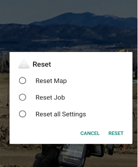
Start-up Reset
If JMT crashes at start and you can’t restore its functionality, reset at startup can be called to reset current map or current job or all settings. Just press and hold volume down physical button (or down arrow button for Victor-2) while JMT starting. A reset menu appears.
-
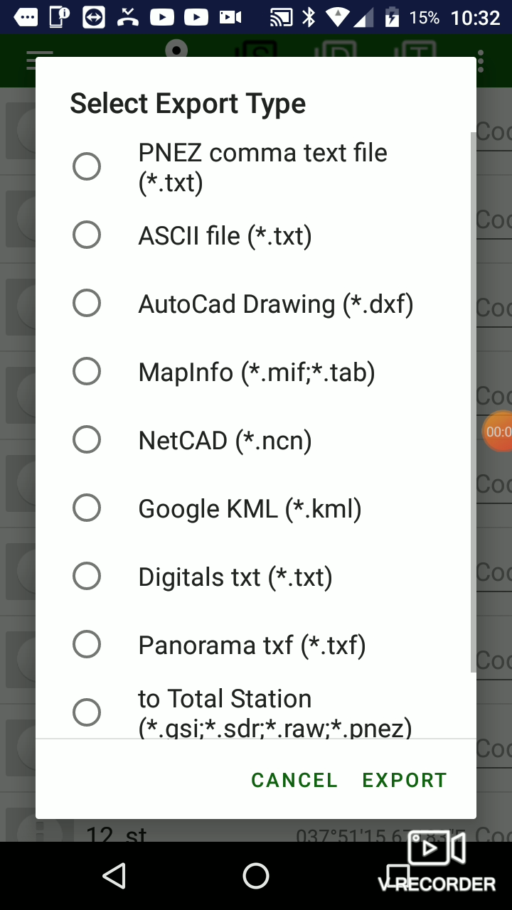
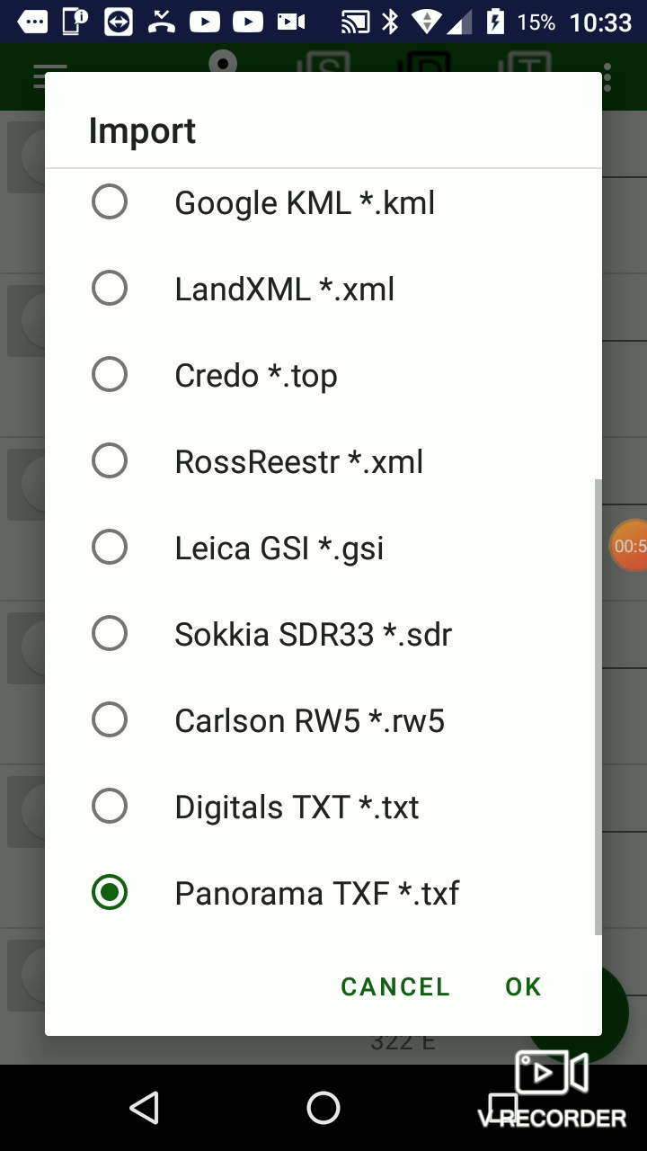
Improved import/export
Import and export supports new formats - Panorama TXF and Digital TXT formats.
 .
. 
Video youtube -
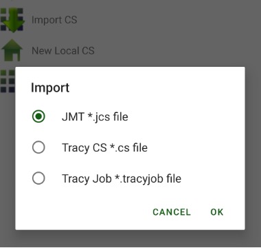
Import / Export of Coordinate Systems
Coordinate system can be imported from files of previous Javad field software – Tracy and from .jcs files created with J-Field or Justin.
-
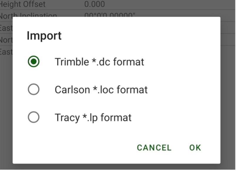
Import/Export localizations
User can import localization from a Trimble .dc file, Carlson .loc file or Tracy.lp file. To do this select Menu | Import. Select format.
-
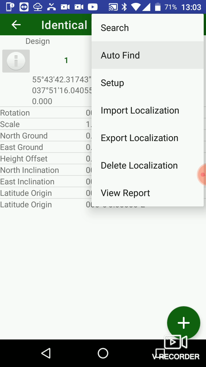
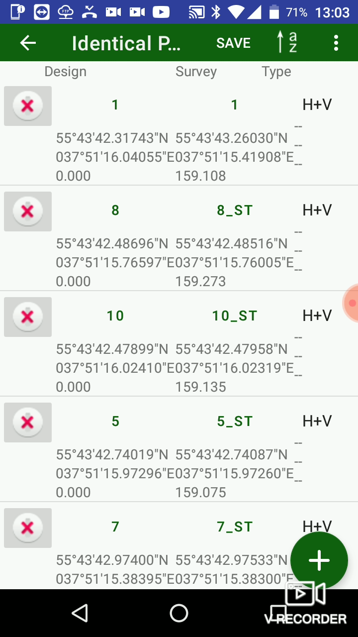
AutoMatch points for localization
Now JMT got an improvement from Tracy - ability to automatically match survey and design points for localization. Surveyor set one pair of identical points and select AutoMatch from menu and JMT finds other matching points automatically.
 ...
... 
Video youtube -
JCORS RTK
If base receiver doesn’t have a public static IP to connect to, a surveyor can use the JCORS service, that is a NetHub software extension / replacement. JMT lets your device to registered in JCORS and lets setup RTK Base and RTK rover using JCORS service. Please read more information on JAVAD JCORS - https://support.javad.com/index.php?threads/jcors.4590/ -
JCORS DPOS
JCORS DPOS is a new verson of DPOS. It will replace standard DPOS with new functionality
Video youtube -
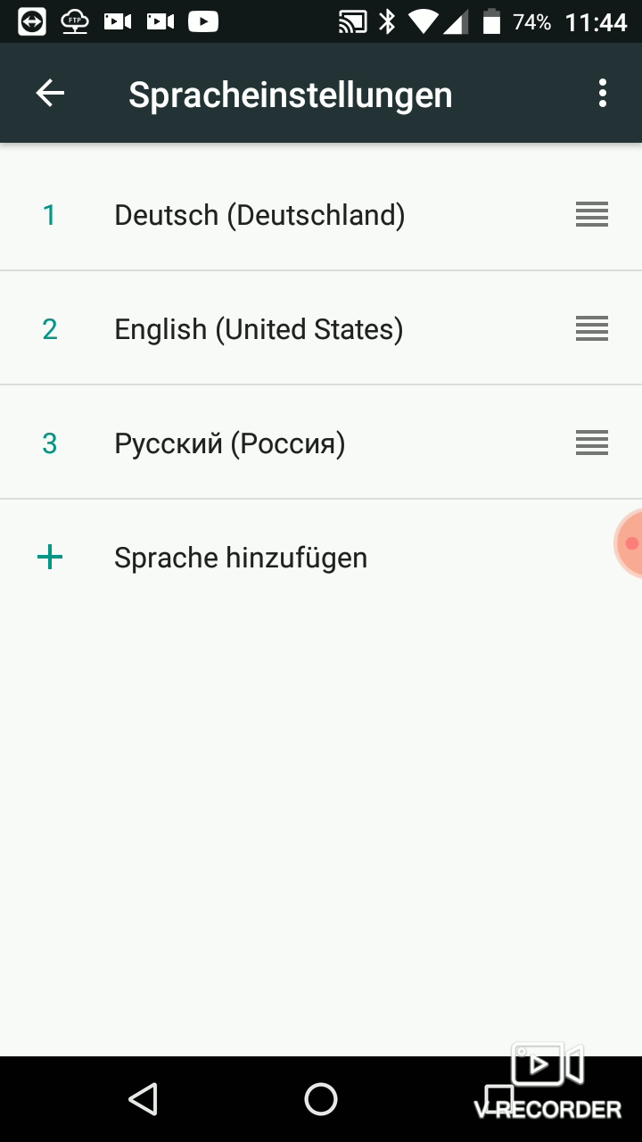
German language translation added
Now JMT is translated to German language. Switch your system language to Deutscher and restart JMT.
 ...
...  ...
...
Video
Video youtube -
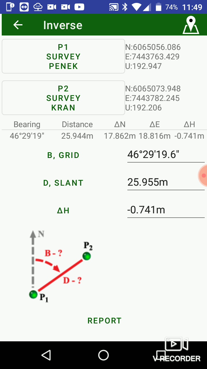
Fixed angles in CoGo tasks
Previously CoGo tasks showed wrong angle values. Now this is fixed.
Video youtube -
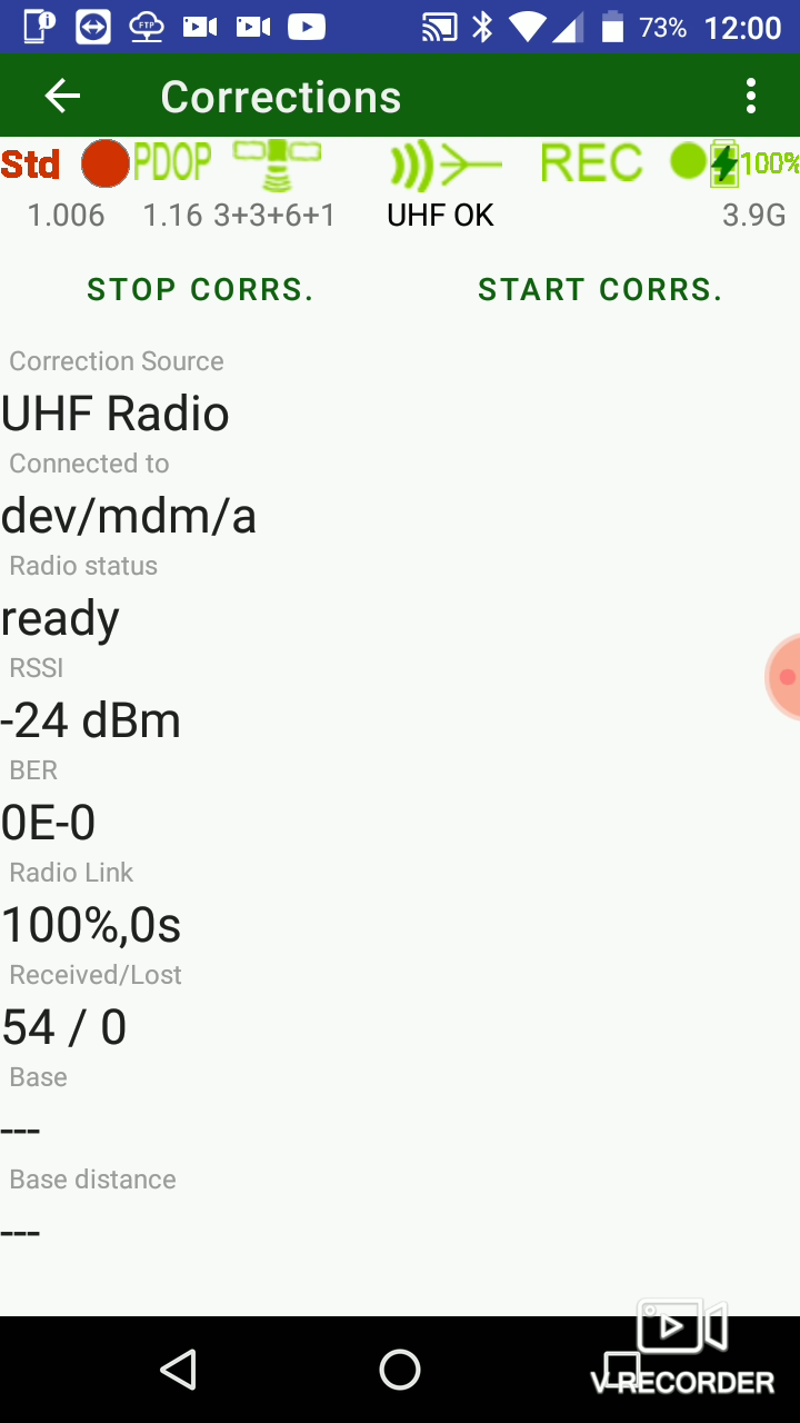
Fixed correction information for UHF of T3 receiver
In previous release it was a bug and JMT can't show correction information for UHF of Triumph-3. Now the issue fixed.
Video youtube -
Fixed UHF with Trimble protocol
It was bug. JMT can't start neither base nor rover UHF with Trimble protocols. Now this is fixed. -
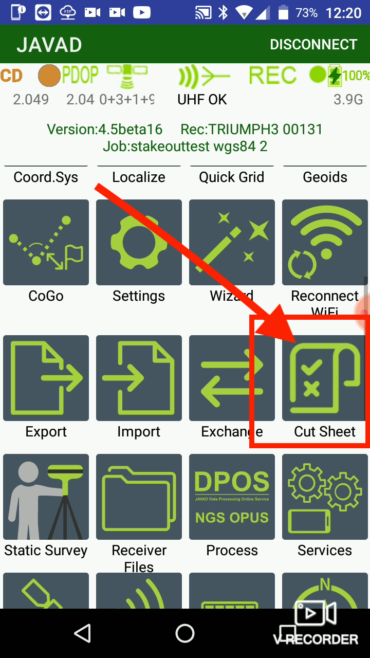
Cut Sheet
As result of stakeou a report has added - Cut Sheet. The report can be exported to text document.
 . ! [07._cutsheet.png](/jmt45new/07._cutsheet.png =150x)
Video youtube -
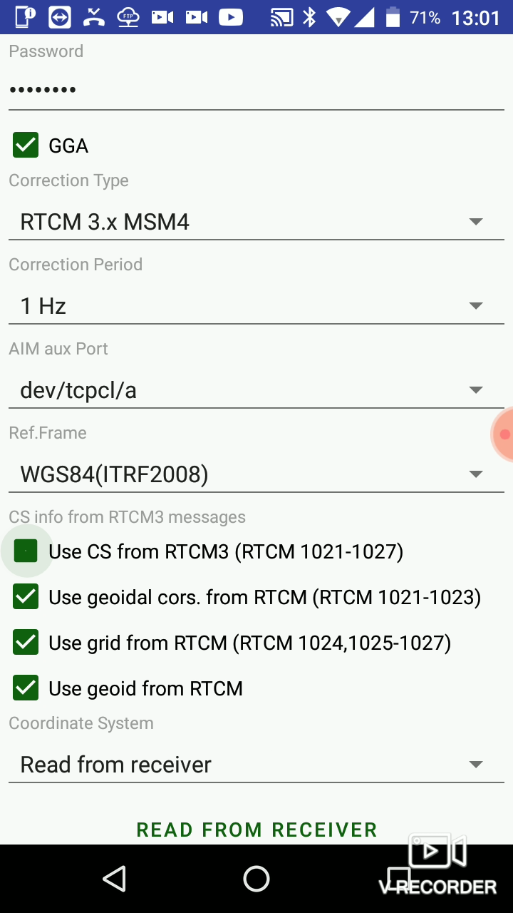
Updated Ntrip screen
Ntrip dialog is changed to be coordinated with other software. Now check boxes is used instaed two dropdowns.
Video youtube -
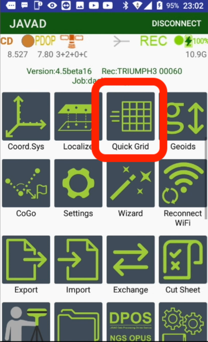
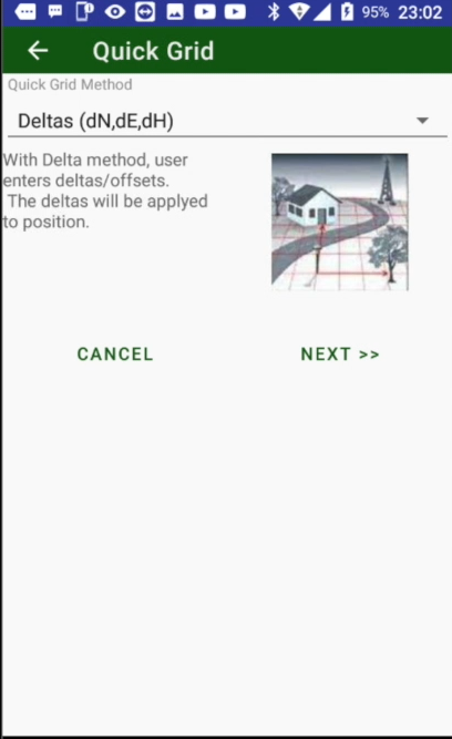
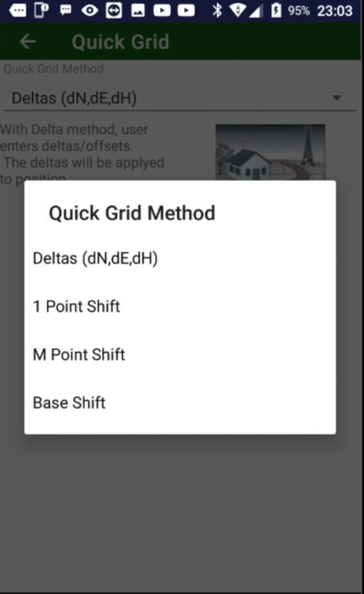
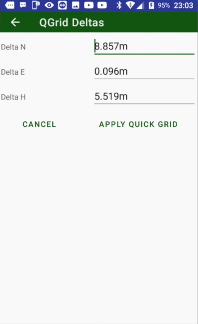
Quick Grid feature
Some time it is required to quickly adjust GPS position without moving all other coordinates (like Localization could help). Quick grid does this - it offset GNSS postion. There are several ways to compute the offset - just type manually or compute by pairs of coordinates.
 .
.  .
.  .
. 
Video youtube -
CAD background is updated
New version of library is used to workwith CAD background. That increased speed and robustness of CAD background
Video youtube -
On map Delete butoon is replaced to Edit
Because just clicking this button remove objects
Video youtube -
PNEZ-PENZ switch for import/export
While export to simplest text format, user can click to PNEZ selector and it will be changed to PENZ to export or import points in different coordinate order – East/North instead of North/East. The setting will be saved till next click. -
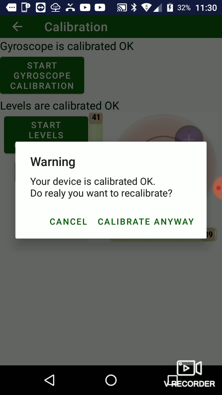
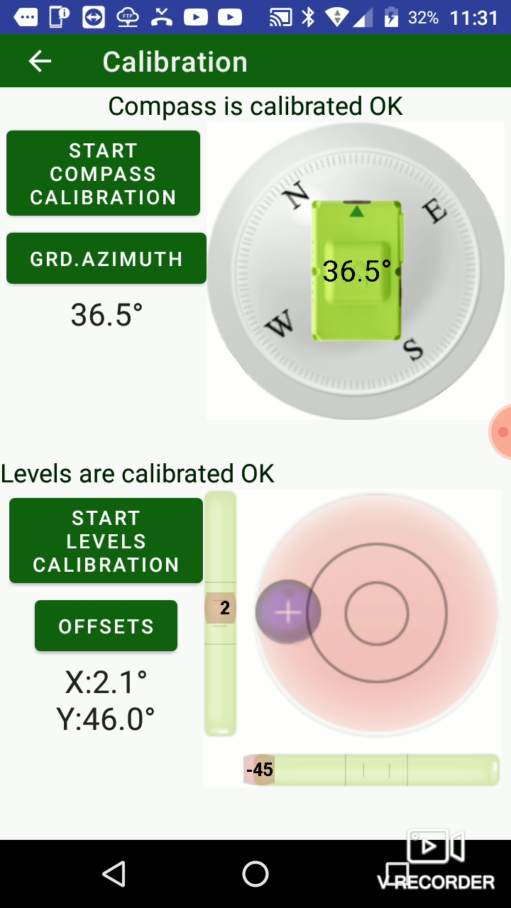
Calibration screen fixed for T2 and T3
JMT 4.4.5 had bugs for both T2 and T3. Now calibration sceeen works for both this receivers.
 .
.  .
.  .
. 
Video youtube -
Hot start for CSD parameter appears
The parameter enables quick activation of built-in cellular radio. Then it is on, power is not off for internal GSM then you off it. The parameter decrease battery life of your receiver but speedup radio activation. -
ReSurvey mode
Repeat surveying can be automated with ReSurvey in Survey settings. It will repeat surveying given number of times. -
Stakeout trail added
JMT can show your previous positions tail inside stakeout bulleye control. The newer positions are darker, the older are visible worse. So you can orient yourself from your previous positions.
¶ Updated Features
¶ RTPK
RTPK includes new parameters like ability to remain raw files. Also it includes support for new features of RTPK in latest firmware.
¶ Improved catalogs
Catalogs user dialog was redesigned.
¶ Catalog export improved
Export from catalog now supports all formats as JMT supports to.
¶ Improved CAD, OSMMap and no-background maps
There are a lot of internal improvements inside backgrounds.
¶ Delete button on map is replaced with Edit
Then an object on map is selected Edit button appears instead of Delete button. With it surveyor can see all information about selected object as well delete it with separate button on edit dialog.
¶ Improved Import / Export
Import and export was improved in many ways, e.g. support of Arc and Circle was added to DXF/DWG and some other formats.
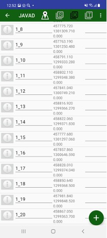
¶ Improved code selection
Code dialog was redesigned to simplify code selection – search and sort commands are supported now.
¶ Improved receiver file dialog
Receiver file dialog includes Start / Stop button to start raw data logging or stop it.
¶ Defects Fixed
• Fixed RTCM3 CS reading
• NAD83 applied to RTPK
• Fixed UHF setup for Trimble protocol
• Fixed Search of points